1. Drainage Basins
Surface water is all the fresh water that is on the surface of the planet: lakes, streams, rivers, etc. This water is easier (and cheaper!) to use than groundwater as it does not require having to drill into the ground to access it. The diversion of irrigation water from surface resources creates significant impacts on the quantity and quality of these water resources and the ecosystems they sustain.
A stream is the general term for a body of flowing surface water of any size. Large streams are termed rivers and small streams have a variety of names such as creeks, brooks, rills, etc. The water that supplies streams comes from melting snow, precipitation, discharging groundwater, flows out of lakes or other surface waters.
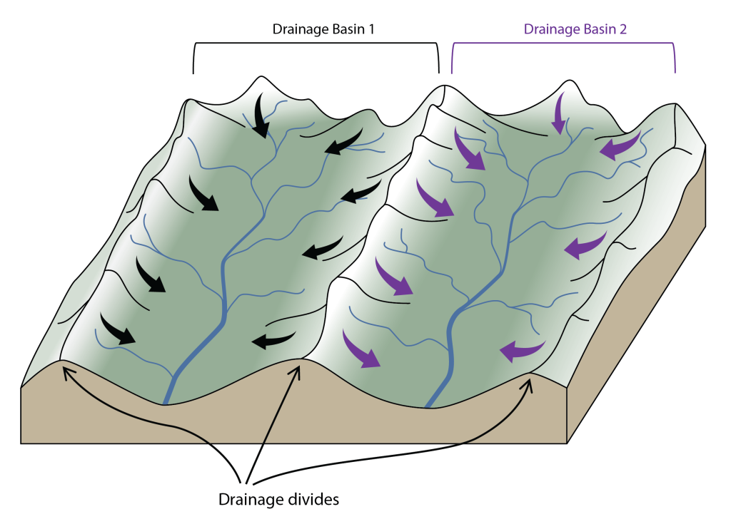
The area from which water flows to form a stream is known as its drainage basin (interchangeably referred to as a watershed in North America). All the precipitation (rain or snow), plus any meltwater or discharging groundwater within this area will eventually flows into its stream and then on to the final destination (typically the ocean), unless some of that water infiltrates into the ground, in which case, it may flow as groundwater into a different watershed. Neighboring watersheds are separated from each other by higher ridges and peaks on the landscape called drainage divides (Figure 2B.1.1).
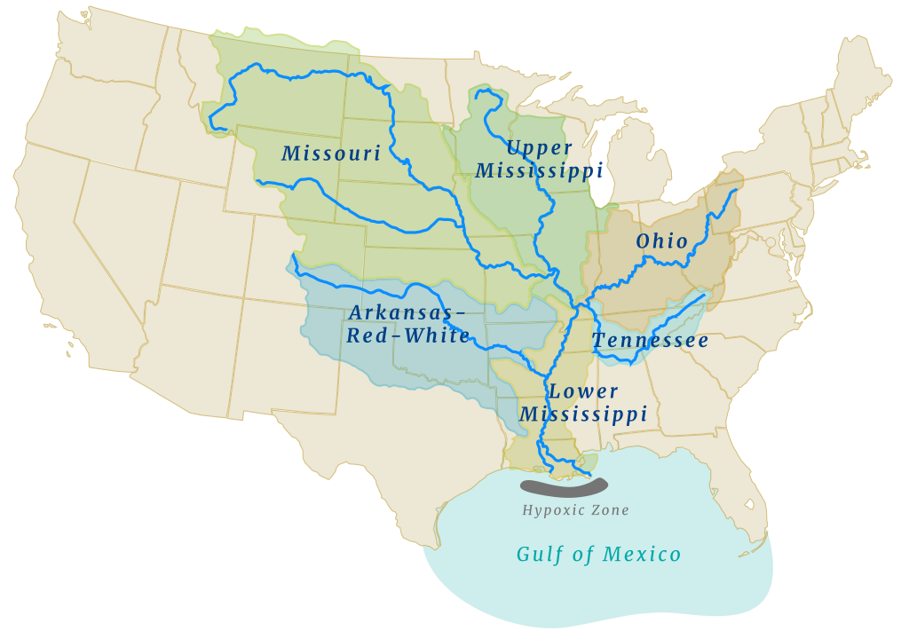
Watersheds can be discussed at different scales, and can be small, such as several small trickles coming together to make a small creek, or large, such as big rivers (and their associated tributaries) that come together to make a major river. The Mississippi-Missouri Watershed is the largest in the U.S. (and 3rd largest in the world!). Within it there are several smaller watersheds, and those contain yet smaller watersheds. The water that falls within these watersheds eventually makes it to the Gulf of Mexico (Figure 2B.1.2). Continental divides are major drainage divides that separate watersheds that flow to different water bodies (e.g., to Gulf of Mexico versus Atlantic Ocean vs. Pacific Ocean).
Check your understanding: Drainage basins
